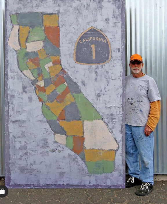
This was no ordinary map project. Every line, every color choice was deliberate, representing a blend of land, counties, and something intangible—a bit of that “poetry of place” I think maps can have when they’re done right. Maps aren’t just lines and data; they’re about what makes a place feel like home. They’re how you connect where you are with how it makes you feel, and maybe even with the journey it took you to get there.
Maps as Art: Finding Simplicity in the Complex
When I first started painting the maps I threw in the names of every county. Each one. Thought I’d be the Google Maps of hand-painted art. But...it got crowded fast. Just way too much going on. It wasn’t saying what I wanted. So, I backtracked and painted out all the names, letting the counties’ shapes and colors speak for themselves. The finished product felt different, almost abstract. It's funny how simplifying a thing can sometimes reveal more of its essence—kind of like giving each line a purpose of its own.
A West Coast Guy’s Surprise Discovery
Now, being a California native, I thought I knew a thing or two about iconic highways. California's Highway 1? The scenery speaks for itself. So, I was surprised to learn about an East Coast version of Highway 1 running along the Atlantic. Who knew? But here’s the thing: painting these two state maps brought out the contrasts in each place. The west coast is this vast stretch of coastal cliffs, forests, and ocean—a mix of natural intensity and beauty that can be both peaceful and dramatic. The east coast, though, has its own charm: its history, those classic shorelines, and that highway running up and down it, like a string connecting every coastal community.
There’s a story in each place, even if the roads are not seen on the mas. And I think that’s what makes mapping out a place feel like making art: every line represents not just what’s there, but how it feels to be there.
Creating Art Through Maps
As I was finishing up thepaintingt, I realized how each line and color took on a life of its own. It’s more than just cartography—it’s about connecting with how people experience their worlds, whether that’s California’s winding coastline of Florida's beaches. And maybe that’s what my client saw, too, hanging California’s map in his Florida home and vice versa. It’s that feeling of seeing what’s familiar in a different place, bringing the poetry of home to a different landscape.


